
Why the North Island works so well by motorhome
The North Island has two very different surf coasts. The west coast faces the Tasman Sea and picks up long swells from the south-west, with black-sand beaches and the left-hand points of Raglan. The east coast faces the Pacific: smaller on most summer days, but it lights up in easterly swells, and it has the warmer water and the softer beach breaks.
The trick is the wind. A westerly blows offshore on the east coast and onshore in the west, and an easterly does the opposite. With a motorhome you are never more than a few hours from the other side, so when one coast is blown out, you drive to the one that is clean. That is the whole plan of this trip: a loop of about 2,100 km over three weeks, with enough slack to wait for the right day.
When to go
I would go in March or April, the New Zealand autumn. Here is why, using Raglan as the example:
Averages over recent years from weather data; tap a spot for daily detail.
- Water is still warm. At Raglan it is about 20 °C in March and 19 °C in April, against 14 °C in August and September. On the east coast at Makorori it is 20 °C in March and 19 °C in April.
- The swell is building. Average wave height at Raglan grows from 1.7 m in January to 2.0 m in March and 2.2 m in April, on the way to the winter peak. At Makorori it goes from 0.6 m in January to 1.0 m in April.
- The summer crowds have gone. The long summer school holidays end in late January or early February. Easter and the April school holidays are busy again, so book campsites early for those weeks.
Summer (December to February) is warmer and great for learners, but the surf is smaller and the beaches are full. Winter (June to September) has the biggest and most consistent waves, but cold water (12 to 16 °C along the route), short days and a lot more rain in the van.
How we get these numbers: every figure comes from years of hourly model data for each spot, the same data you see on each spot page. Wave heights are averages for the month, not the size of the best day.
The route, week by week
Week 1: Auckland's west coast, Raglan and Taranaki
Start in Auckland and spend the first days on the west coast beaches, 45 minutes from the city: Piha, Muriwai and Bethells Beach. All three have strong rips; surf between the flags when they are patrolled.
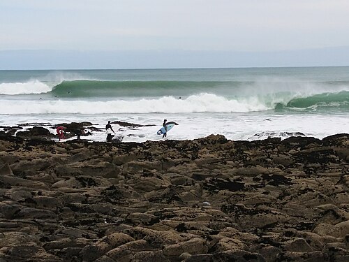
Then drive about 150 km south to Raglan. The left-hand points of Manu Bay, Whale Bay and Indicators are for intermediate and experienced surfers; Ngarunui Beach is the place to learn. Give Raglan three or four days.
From Raglan it is about 260 km to New Plymouth and Taranaki. Surf Highway 45 runs around Mount Taranaki past dozens of breaks. Fitzroy Beach is in town, Ōakura is a mellow beach break 15 minutes south-west, and Stent Road and Ōpunake are further round the mountain. Taranaki is the place to sit for a few days: there is almost always one side of the mountain with an offshore wind.

Week 2: Wellington, the Wairarapa and Hawke's Bay
From Ōpunake it is the longest leg of the trip, about 325 km, down to Wellington. Lyall Bay is the city's surf beach, right next to the airport, and it works best in a northerly wind. Wellington is also where the water gets cooler: about 17 °C at Lyall Bay in April.
Then cross the hills to the Wairarapa coast and Castlepoint, about 165 km away: a beach break for learners in front of the village and reef breaks at Slippery and The Gap. The reef is dangerous in a big sea, and help is far away, so surf with others.
Next comes a long day north, about 300 km, to Hawke's Bay and Waimārama, 20 minutes from Havelock North. It is a beach break that likes an easterly swell with a westerly wind, and it is known for strong rips.

Week 3: Māhia, Gisborne, the Bay of Plenty and the Coromandel
About 210 km north of Waimārama, the Māhia Peninsula has waves on several coasts: Ōpoutama for learners, the reefs at Blacks for experienced surfers only. It is remote and quiet, a good place to slow down.
Gisborne is about 80 km further. Midway Beach is the friendly town beach, Wainui is more exposed, and Makorori is the most consistent, with a rocky right-hand point at its southern end.
From Gisborne, cross inland to the Bay of Plenty (about 180 km to Ōhope): Ōhope Beach and Mount Maunganui both need a swell from the north to east. Finish on the Coromandel at Whangamatā, where the bar is for experienced surfers, and Hot Water Beach, which has strong rips but also hot springs in the sand at low tide. From there it is about 175 km back to Auckland.




Reading the swell and wind on the road
- West coast (Auckland beaches, Raglan, Taranaki): best in a south-west swell with an easterly or south-easterly wind. Mornings are often cleanest before the sea breeze.
- East coast (Wairarapa, Hawke's Bay, Gisborne, Bay of Plenty, Coromandel): needs a swell from the south-east, east or north-east, and a westerly wind is offshore. Tropical lows in late summer and autumn can send solid easterly swells.
- Keep the plan loose. Look at the forecast every evening and be ready to swap the order of the next two stops. The route above works in both directions.
Motorhome and camping rules
- Freedom camping needs a certified self-contained vehicle. On council land you can only freedom camp in a vehicle with a valid green self-containment warrant and a fixed toilet, unless a site is set aside for other vehicles. The old blue warrants stopped counting on 7 June 2026. Each council sets its own places and limits, so check the local rules and the signs.
- Other options: Department of Conservation campsites (many are close to the coast and simple), and holiday parks with power, showers and dump stations. In the busy weeks, book ahead.
- Driving: New Zealand drives on the left, and many coastal roads are narrow and winding. A motorhome is slower than the map times, so keep driving days short and leave a free day every few days.
Safety
Many of the beaches on this route have strong rips, and several are remote. Surf with others, surf between the flags where the beach is patrolled (mostly in summer), and ask locals before paddling out at an unfamiliar reef. The emergency number is 111. Read the hazards on each spot page before you go; they are written for that beach.
What to pack
- A 3/2 wetsuit for March in the north, a 4/3 for April and for Wellington and the Wairarapa, where the water is 16 to 17 °C in April. Booties are useful on the reefs.
- A board for small days and one with more volume or length for the points and bigger swells.
- Warm layers for the evenings: autumn nights in a van get cool.
FAQ
How long do you need for a North Island surf trip?
Three weeks lets you do the full loop without rushing. With two weeks, pick one side: Raglan and Taranaki, or the east coast from Gisborne to the Coromandel.
Is March or April better?
March is warmer: water around 20 °C at Raglan and Makorori and fewer people after the summer holidays. April has slightly bigger waves at most spots but cooler water, and the Easter and school holidays bring the crowds back for a while.
Can beginners do this trip?
Yes, with care. Learner-friendly stops include Ngarunui Beach at Raglan, Ōakura, Midway Beach in Gisborne, Ōpoutama at Māhia and Castlepoint Beach. Take a lesson at the start, and leave the points, bars and reefs to experienced surfers.
Do I need a self-contained motorhome?
Only if you want to freedom camp on council land. If you plan to stay at holiday parks and DOC campsites, any van works.
Plan each stop on Best Time to Ride: every spot page shows the best months, wave height, water temperature and local hazards. Start with Raglan and the New Zealand surf spots.


